✆ + 1-646-235-9076 ⏱ Mon - Fri: 24h/day
3 months
Project duration
Outsource
Engagement model
4 Developers
Team size
Ireland
Client
Project Introduction
Fordewind.io team developed an Agriculture Asset Tracking System – cross-platform mobile application for monitoring of people in agricultural zones with working agricultural harvesters.
By integrating advanced technology and real-time data communication, this mobile application provides farmers and agricultural workers with enhanced monitoring capabilities and improved safety protocols.
Core functionality included setup of hazard zones and online control of proximity between people and operating machines.
Key Features:
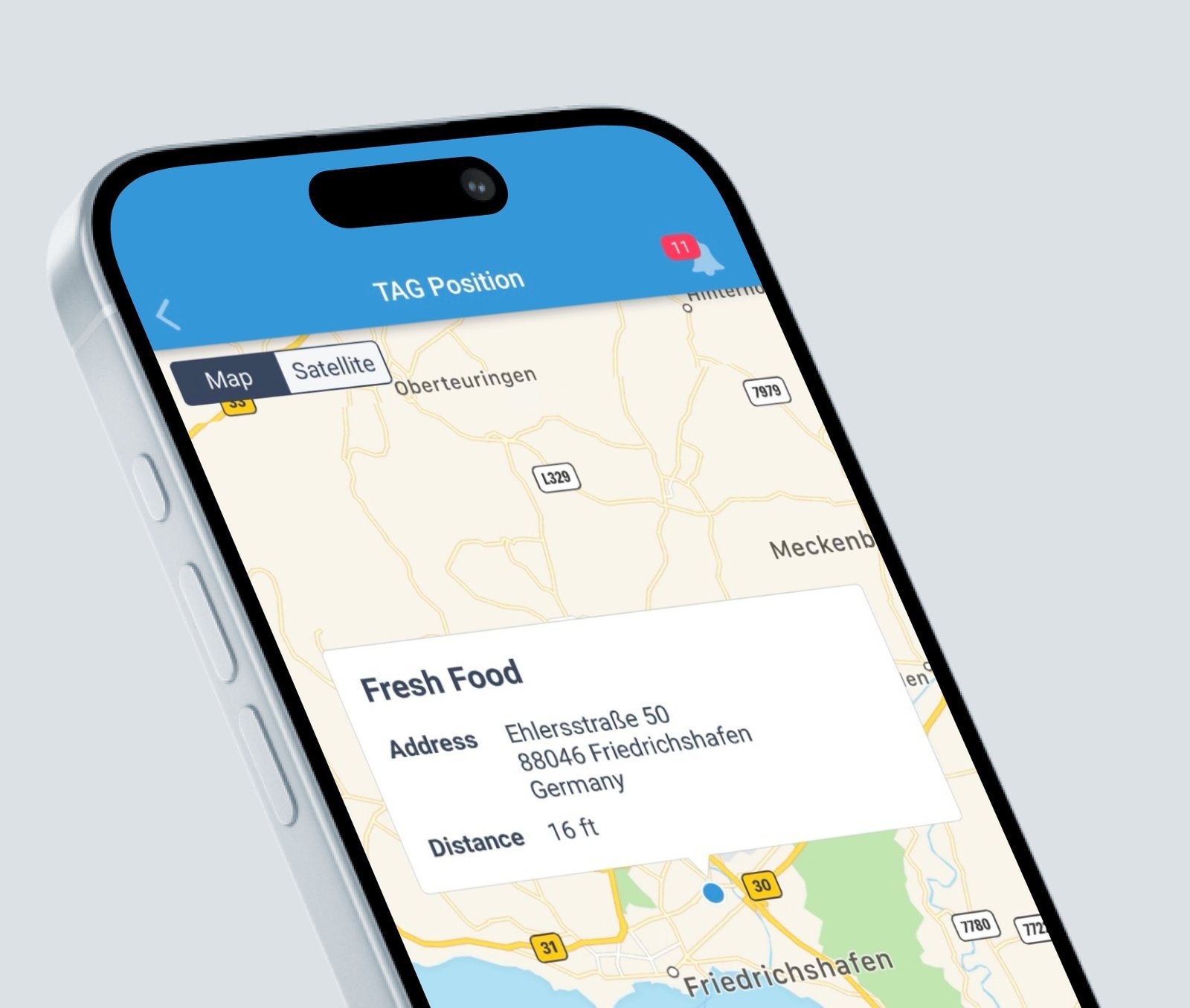
– Real-time location tracking: Users wear wearable devices that transmit their location, allowing others to monitor their whereabouts within the farm boundaries.
– Geo-fencing: Virtual fences can be set up around potential hazards, triggering alerts if a user enters a restricted area.
– Panic button: Users can instantly send an SOS alert with their location, prompting others to respond quickly.
– Two-way communication: Users can make and receive calls within the group using the app, facilitating coordination and assistance.
– Family groups: Multiple users can be linked together, enabling group monitoring and communication.
– Subscription-based service: Offers different tiers with varying functionalities to suit individual needs.
The goal of the Agriculture Asset Tracking System was to create a platform for mitigating risks and improving overall safety standards in the agricultural industry.
Scope of Project
The Fordewind project’s responsibilities encompass both the backend application and the Android application, each with its specific features and functionalities tailored to the overarching goal of enhancing safety and monitoring capabilities in agricultural zones. Let’s delve deeper into each aspect:
The responsibilities of the project, as outlined in the project’s description, encompass both the backend application and the Android application. Here’s a more detailed overview:
1. Backend Application (Java)
The backend application serves as the central component responsible for managing data, user interactions, and communication between different parts of the system. Its features include:
1. User Group Management:
– Implementing functionality to create, modify, and delete user groups. This involves maintaining a database of users and their respective group memberships.
– Handling user authentication and authorization to ensure secure access to the application’s features.
2. Zone Management:
– Providing tools for adding and removing hazard zones based on predefined rules. This involves defining rules for zone creation, such as size, location, and conditions for activation or deactivation.
– Allowing users to create custom zones and rules tailored to their specific needs and requirements.
3. Rule Management:
– Enabling users to define rules associated with hazard zones, such as notification triggers, safety protocols, and actions to be taken in case of proximity violations.
– Implementing logic to enforce these rules in real-time, ensuring that safety protocols are followed and risks are mitigated effectively.
4. Notification Integration with Firebase Cloud Messaging (FCM):
– Setting up communication channels with FCM to enable real-time notifications to users’ devices.
– Configuring triggers for notifications based on proximity to hazard zones, rule violations, or other relevant events.
– Ensuring reliable delivery of notifications to keep users informed about potential risks and safety measures.
2. Android Application
The Android application serves as the interface through which users interact with the system, providing essential features for monitoring and ensuring safety in agricultural zones. Its responsibilities include:
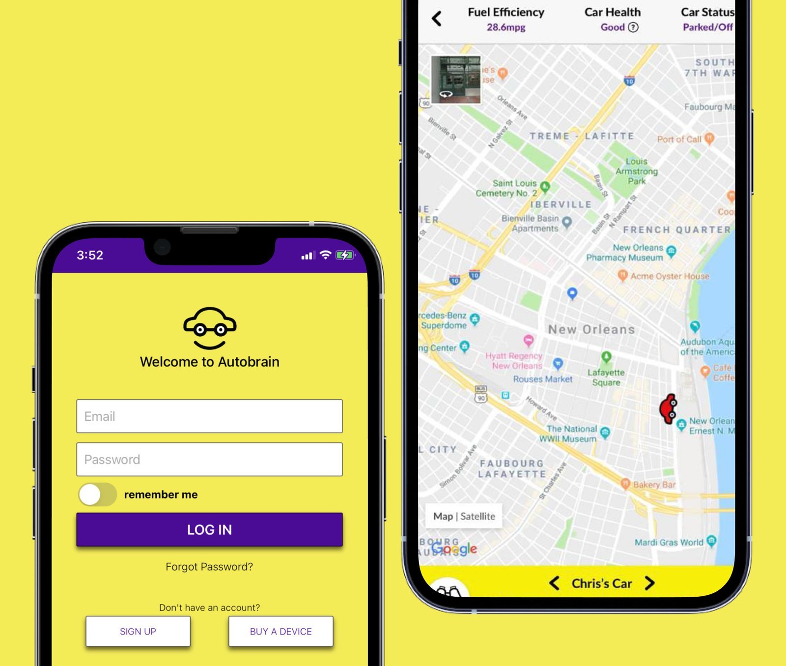
1. Location Determination:
– Utilizing device sensors, including GPS technology, to accurately determine the user’s current location within the agricultural zone.
– Continuously updating the user’s location to track movements and monitor proximity to hazard zones and operating machines.
2.Geofencing with GPS Technology:
– Implementing geofencing functionality using GPS technology to define virtual boundaries around hazard zones.
– Monitoring the user’s position relative to these boundaries and triggering alerts or actions when entering or exiting designated areas.
3. Proximity Monitoring:
– Utilizing proximity sensors or distance calculation algorithms to assess the distance between users and operating agricultural machines.
– Providing real-time feedback to users regarding their proximity to potential hazards, enabling them to take appropriate safety measures.
Project’s Specifics
Results

1. Increased safety
Real-time location tracking and alerts provide a safety net, especially for vulnerable individuals. This mobile application enhances protection for vulnerable individuals in agricultural settings: Children’s real-time location tracking prevents them from accessing hazardous areas, while geo-fencing alerts notify farmers of restricted zone breaches. For older adults, a panic button enables immediate help requests, with remote monitoring by family members to prevent isolation. Additionally, farm workers benefit from improved communication and coordination through the app, ensuring support and connectivity in remote environments.
2. Reduced anxiety
Our project brings reduced anxiety to farmers and their families by providing real-time location tracking and instant alerts, allowing farmers to focus on tasks with peace of mind and families to remotely monitor their loved ones on the farm, fostering a sense of connection. This leads to improved sleep and overall well-being, enhancing quality of life and creating a positive farm environment.
3. Improved efficiency
Streamlines communication on the farm by enabling instant messaging, saving time and improving coordination during critical tasks. Additionally, the app enhances task management through optimized allocation and resource deployment based on real-time location data, reducing downtime and ensuring prompt responses to emergencies for uninterrupted operations.
4. Scalability
The system offers adaptable solutions for farms of any size, with customizable features such as adjustable geofences and modular functionality tailored to specific needs and budgets. Additionally, seamless integration with existing farm management software enhances data collection efficiency and provides a centralized platform for safety information, ensuring scalability and compatibility across different farm setups.
Similar Case Studies
Contact Us
New York
348 W. 57th St., New York, NY 10019
+16462359076
contact@fordewind.io
Vancouver, Canada
W Georgia St, Vancouver, Canada
+16462359076
contact@fordewind.io
Warsaw, Poland
Plac Europejski 4, Warsaw, Poland
+48452478282
contact@fordewind.io
Tallinn, Estonia
Kesklinna linnaosa, Kaupmehe, 10114, Estonia
contact@fordewind.io
Kyiv, Ukraine
19 Koval’s’kyi Lane, Kyiv, Ukraine
+380967764322
contact@fordewind.io